Archaeometry 2025: Non-Destructive Technologies and Excavations
Excavation sites no longer resemble those of twenty years ago. Alongside brushes and trowels, laser scanners, portable spectrometers, and artificial intelligence algorithms are now commonplace. Archaeometry—the scientific discipline that applies physical and chemical methods to past remains—is reaching a new milestone in 2025 with the rise of non-destructive technologies. These innovations allow for the exploration, analysis, and documentation of archaeological heritage without altering or removing objects, radically transforming the planning of field interventions.
From Surface to Subsurface: Mapping Before Excavating
Even before the first pickaxe is laid, scientific teams now have remote sensing tools that reveal buried structures. Airborne LiDAR (Light Detection and Ranging) captures millions of points in a few hours, producing high-resolution altimetric models capable of detecting topographical anomalies invisible to the naked eye. Coupled with orthophotography and satellite imagery, this process facilitates the reconstruction of ancient landscapes and the localization of potential areas of interest.

On the ground, SLAM mapping (Simultaneous Localization and Mapping) and fixed scanners provide detailed 3D models of excavated structures. These surveys allow for the analysis of slopes, stratigraphic sections, and construction phases, providing archaeologists with crucial data to anticipate interventions and calculate the impacts of future excavations. The vectorization of historical cadastres further enriches this mapping by superimposing ancient documentary traces onto modern surveys.
Geophysical methods complement this subterranean overview: ground-penetrating radar, magnetometry, and electrical prospecting reveal the presence of buried walls, pits, or metal objects without the need for excavation. These techniques, already well-established, now benefit from increased resolution and more powerful processing algorithms, facilitating the detection of complex structures.
| Mapping Technique | Function | Benefit |
|---|---|---|
| Airborne LiDAR | Detection of topographical anomalies | Reconstruction of ancient landscapes, localization of areas of interest |
| SLAM Mapping | Detailed 3D modeling | Analysis of slopes, stratigraphies, construction phases |
| Geophysical Methods | Revelation of buried elements (ground-penetrating radar, magnetometry, electrical prospecting) | Detection of walls, pits, metal objects without excavation |
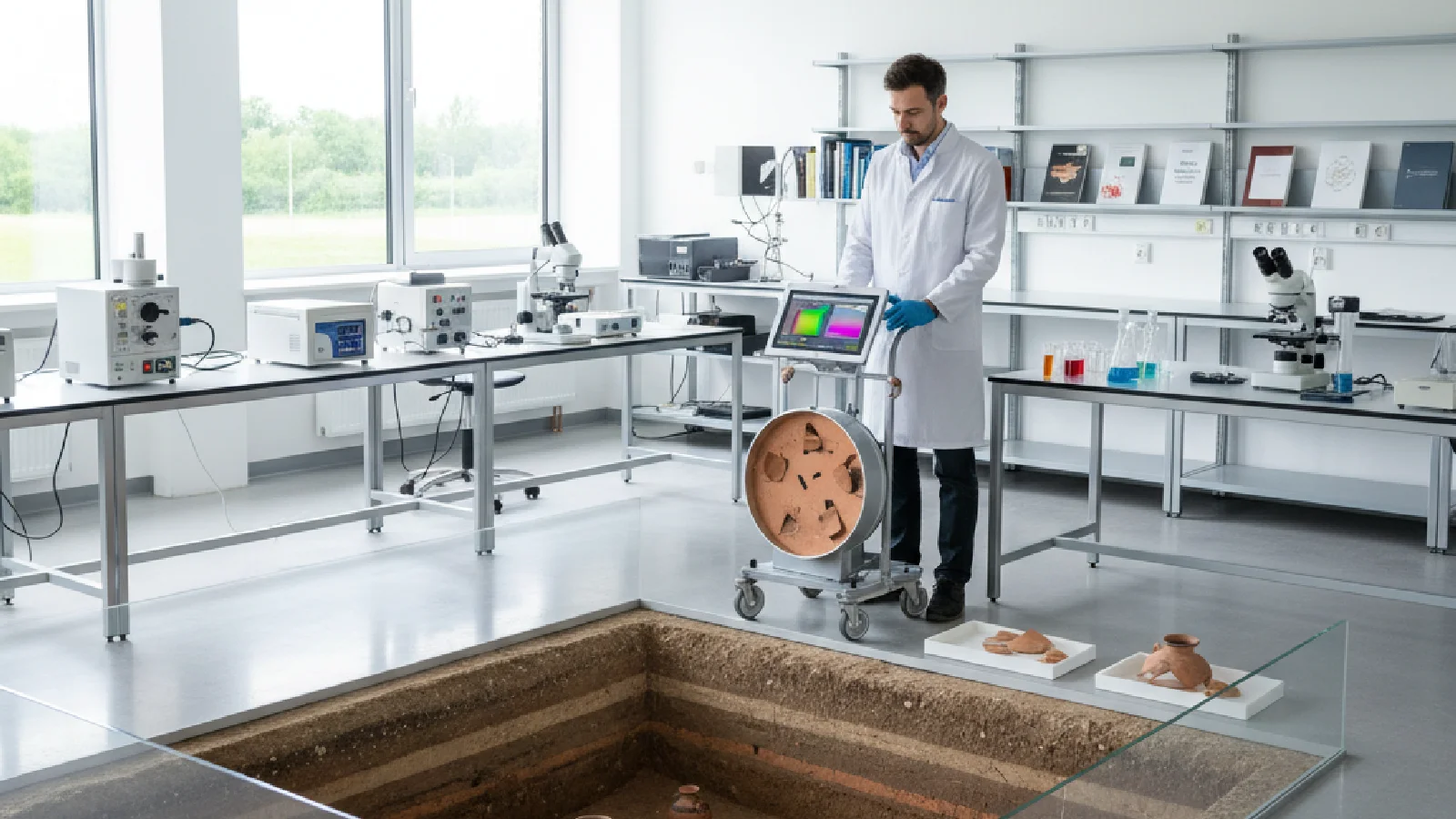
Analyzing Without Sampling: Portable Spectroscopy at the Heart of Excavations
Once remains are unearthed, chemical and mineralogical analysis is essential to understand their composition, provenance, and state of preservation. Portable X-ray fluorescence spectrometers (pXRF) have become widespread on archaeological sites: these pistol-sized devices detect the elemental signature of ceramics, metals, pigments, or soils in a few seconds, without requiring sampling.
However, the geometry of measurements poses a challenge: the angle of incidence of the beam and the distance to the object influence the results. This is where artificial intelligence comes in: automatic correction algorithms now compensate for these distance and orientation effects, making the data robust regardless of the device's position. This advance, presented at the XXVth GMPCA colloquium (Group of Multidisciplinary Methods Contributing to Archaeology) in Rouen in April 2025, allows teams to multiply in situ measurements without fear of methodological bias.
“Artificial intelligence corrects distance and angle effects in XRF measurements, making data robust regardless of geometry.”

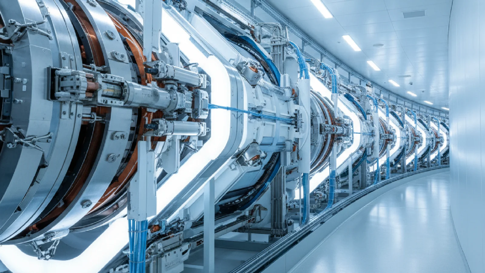
In the Laboratory: Synchrotron X-rays and Microscopic Resolution
When objects reach laboratories, synchrotron techniques take over for even finer analyses. XANES (X-ray Absorption Near Edge Structure) and XRD (X-ray Diffraction) methods offer chemical and structural resolution at the microscopic scale, allowing for the identification of mineral phases, organic pigments, or oxidation states of metallic elements.
These analyses reveal not only the original composition of materials but also ongoing degradation processes. They thus guide conservation strategies and direct future excavation campaigns towards areas with optimal preservation conditions. The combination of this data with 3D surveys and field spectrometric measurements creates an integrated analytical ecosystem, where each technique complements the others without destructive duplication.
This multi-scale approach finds a striking illustration in 3D imaging techniques used for the study of fragile or sealed objects, as we will see in the next section.
Reading Without Opening: Tomography and Virtual Unrolling
Some archaeological objects remain inaccessible by traditional methods: carbonized manuscripts, sealed vases, wrapped mummies. X-ray tomography (CT-scan) and virtual unrolling of documents offer an elegant solution: they allow for the visualization of the interior of objects without ever opening them.
The virtual unrolling process, applied notably to the carbonized papyrus scrolls discovered in Herculaneum, relies on several steps:
- High-resolution tomographic acquisition to capture material density layer by layer
- Digital segmentation of compacted or superimposed sheets
- Volumetric reconstruction and virtual “flattening” of the support
- Image processing to reveal traces of ink or pigments
This approach preserves the physical integrity of objects while revealing their textual or iconographic content, ensuring long-term preservation and providing crucial information to guide future intervention strategies. Applied to other contexts, tomography also allows for the examination of the internal structures of ceramics, corroded metals, or fossilized bones.
Links with other emerging scientific fields naturally appear: thus, advances in non-destructive imaging echo research on superconductors optimized by chemical modification, where fine analysis techniques reveal structures at the atomic scale.
Artificial Intelligence and Predictive Modeling
The integration of artificial intelligence is not limited to correcting instrumental biases. Deep learning algorithms now analyze LiDAR images to automatically detect topographical anomalies, classify XRF spectra to identify provenance groups, or predict areas of accelerated degradation from environmental data.
These predictive modeling tools transform excavation planning by allowing anticipation of where to focus efforts, which structures require urgent intervention, and which conservation strategies to adopt. AI also facilitates the reconstruction of dispersed fragments: by comparing thousands of fracture profiles or partial decorations, it proposes coherent assemblies that researchers can then validate.
This computational dimension is part of a reproducible science approach, where raw data, algorithms, and results are documented and shared within the scientific community. The GMPCA 2025 colloquium dedicates an entire theme to the articulation between modeling, computational analysis, and geovisualizations, highlighting the importance of this interdisciplinarity.
Towards Augmented Preventive Archaeology
All these innovations converge towards a new form of preventive archaeology: rather than intervening after the fact, teams can now assess risks, prioritize, and adjust their protocols based on objective data collected before, during, and after excavations.
The benefits are numerous. Scientifically, the multiplication of non-destructive measurements considerably enriches site documentation, allowing for longitudinal studies and inter-site comparisons. In terms of heritage, the preservation of fragile objects is maximized, ensuring their transmission to future generations. Operationally, optimizing interventions reduces delays and costs while improving team safety and the quality of results.
The impact extends far beyond archaeology in the strict sense: techniques developed for the study of remains find applications in conservation-restoration, geology, paleontology, and even forensic medicine. Like research on telomeres and longevity, advances in archaeometry illustrate how sophisticated analytical tools can revolutionize the understanding of complex processes, whether biological or cultural.
Challenges and Future Perspectives
Despite these advances, several challenges remain. Access to cutting-edge research infrastructures, such as synchrotron sources or high-performance computing platforms, remains limited and unevenly distributed geographically. Training archaeologists in spectrometric methods, 3D modeling, and big data analysis is a major challenge for the coming years.
The question of standardization of protocols and data interoperability is also acutely posed. For results to be comparable from one site to another, from one laboratory to another, common standards for data acquisition, processing, and storage must be defined. European and international initiatives are working in this direction, but the path is still long.
Finally, non-destructive archaeometry raises ethical and heritage questions. While these techniques preserve objects, they also generate immense volumes of digital data whose sustainability must be guaranteed. Who preserves these archives? How can they be made accessible to future researchers? How can an overabundance of data be prevented from drowning out relevant information?